


UAV Services for Rail Infrastructure UK | Apex Engineering
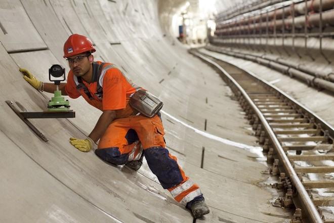
UAV Services for Rail Infrastructure in the UK
Maintaining rail infrastructure requires accurate inspections, reliable surveying, and careful monitoring of assets. Traditional inspection methods can sometimes involve working at height, accessing difficult locations, or disrupting railway operations. This is where UAV services for rail infrastructure can provide a safer and more efficient approach.
Unmanned aerial vehicles, commonly known as drones, can capture high-resolution imagery and data from areas that may be difficult or hazardous to access manually. For rail operators, infrastructure managers, contractors, and engineering teams across the UK, UAV technology can support inspection, surveying, maintenance planning, and asset monitoring.
Apex Engineering Services provides engineering and surveying expertise to help clients collect useful information and make better-informed decisions about infrastructure.
Why Use UAV Services for Rail Infrastructure?
Railways include bridges, tunnels, embankments, viaducts, stations, overhead structures, trackside assets, and other complex infrastructure. Inspecting these assets regularly is essential for identifying defects and planning maintenance.
Using UAV services for rail infrastructure can help engineering teams collect visual information while reducing the need for personnel to physically access challenging areas.
Key applications can include:
- Infrastructure inspections
- High-level visual surveys
- Bridge and viaduct inspections
- Embankment monitoring
- Trackside asset surveys
- Construction progress monitoring
- Photogrammetry and mapping
- Condition assessment
- Post-maintenance inspections
Improving Inspection Efficiency
UAVs can cover areas quickly and capture detailed imagery that can later be reviewed by engineering professionals. This can make it easier to identify visible cracking, deterioration, vegetation growth, surface damage, or other conditions requiring further investigation.
Drone surveys can also provide useful records for comparing asset conditions over time, supporting proactive maintenance strategies.
How UAV Surveys Support Rail Safety
Rail infrastructure inspections must be carefully planned because railway environments can present significant operational and safety risks. UAV surveys can reduce the requirement for inspectors to enter certain difficult-to-reach locations.
However, drone operations around railway infrastructure still require appropriate planning, permissions, risk assessments, competent operators, and compliance with applicable aviation and railway requirements.
The purpose is not simply to replace conventional inspections. Instead, UAV data can complement existing engineering inspection methods and provide an additional source of information.
Supporting Better Maintenance Decisions
Accurate inspection information helps asset managers determine where further investigation or maintenance may be required. High-quality aerial imagery can provide valuable context when engineers are assessing infrastructure condition.
When combined with other surveying and engineering techniques, UAV data can contribute to a more complete understanding of an asset.
Combining UAV Surveys with Ground Investigation
Rail infrastructure often requires more than visual inspection. Some structural issues or subsurface conditions cannot be identified from aerial imagery alone.
This is where complementary technologies such as ground penetration radar concrete scanning and rebar mapping can become valuable.
Ground penetrating radar can help investigate subsurface conditions, while concrete scanning and rebar mapping can provide information about reinforcement and features within concrete structures.
Ground Penetrating Radar and Concrete Assessment
Concrete structures such as bridges, retaining walls, platforms, and other rail assets may require detailed investigation before drilling, cutting, modification, or repair work.
Ground penetration radar concrete scanning and rebar mapping can help identify reinforcement and other embedded features, supporting safer planning for engineering works.
Combining aerial inspection with ground-based investigation can provide a broader picture of infrastructure condition. UAV imagery may identify visible external issues, while specialist scanning can provide information about internal or concealed elements.
Benefits for UK Rail Infrastructure Projects
The UK rail environment presents a wide range of infrastructure challenges. Engineering teams may need to inspect ageing assets, monitor construction activity, assess difficult locations, and plan maintenance while minimising operational disruption.
UAV services for rail infrastructure can support these requirements by providing detailed visual data without always requiring traditional access methods.
Potential benefits include:
- Reduced exposure to work-at-height risks
- Faster data collection
- High-resolution visual records
- Access to difficult locations
- Improved maintenance planning
- Repeatable inspection data
- Support for engineering assessments
The exact benefits depend on the project, asset type, operating environment, and survey requirements.
Why Choose Apex Engineering Services?
Choosing the right engineering partner is important when working with complex infrastructure. Apex Engineering Services combines technical expertise with practical surveying and inspection solutions designed around project requirements.
Whether you require UAV data for a rail asset inspection or specialist investigation using ground penetration radar concrete scanning and rebar mapping, a coordinated engineering approach can help provide more useful information for decision-making.
Before commissioning a survey, discuss the asset type, required outputs, access conditions, project timescales, and any relevant railway requirements with your engineering provider.
Frequently Asked Questions
What are UAV services for rail infrastructure?
They involve using unmanned aerial vehicles to collect imagery, survey data, and other information from railway assets such as bridges, viaducts, embankments, and trackside infrastructure.
Can drones inspect railway bridges?
UAVs can be used to capture detailed visual information from bridges and other difficult-to-access structures, subject to appropriate operational planning, permissions, and safety requirements.
What is ground penetration radar concrete scanning and rebar mapping?
These techniques use specialist scanning technology to investigate concrete and identify features such as reinforcement and other embedded elements before construction or engineering work.
Can UAV surveys replace traditional rail inspections?
Not necessarily. UAV surveys are generally best considered a complementary inspection and surveying method. The appropriate approach depends on the asset and project requirements.
Why combine UAV surveys with concrete scanning?
Aerial surveys can provide information about visible external conditions, while concrete scanning and rebar mapping can investigate concealed features. Together, they can provide a more comprehensive assessment.
Plan Your Rail Infrastructure Survey
Reliable infrastructure data can make a significant difference when planning inspections, maintenance, repairs, and construction work. From aerial asset surveys to specialist structural investigation, the right combination of technologies can help engineering teams work more efficiently and make informed decisions.
If you are looking for UAV services for rail infrastructure in the UK, contact Apex Engineering Services today to discuss your project requirements and explore a suitable inspection or surveying solution.

 English
 Arabic
 French
 Spanish
 Portuguese
 Deutsch
 Turkish
 Dutch
Dutch
 Russian
 Romaian
 Portuguese (Brazil)
 Greek
Greek